

Precision Coastal Monitoring, Delivered at Any Scale.
At Strike Harbor Geomatics, we provide reliable coastal monitoring services tailored to meet the specific requirements of local coastal commissions and regulatory agencies. Whether your project calls for rapid turnaround with simple JPEG imagery delivered as soon as the next day, or more advanced geospatial products like high-resolution orthomosaics, 3D terrain models, and detailed contour mapping, our team is equipped to deliver accurate, actionable data on your required schedule. We combine technical expertise with flexible workflows to support projects of any complexity, ensuring you get exactly the level of detail you need—when you need it.
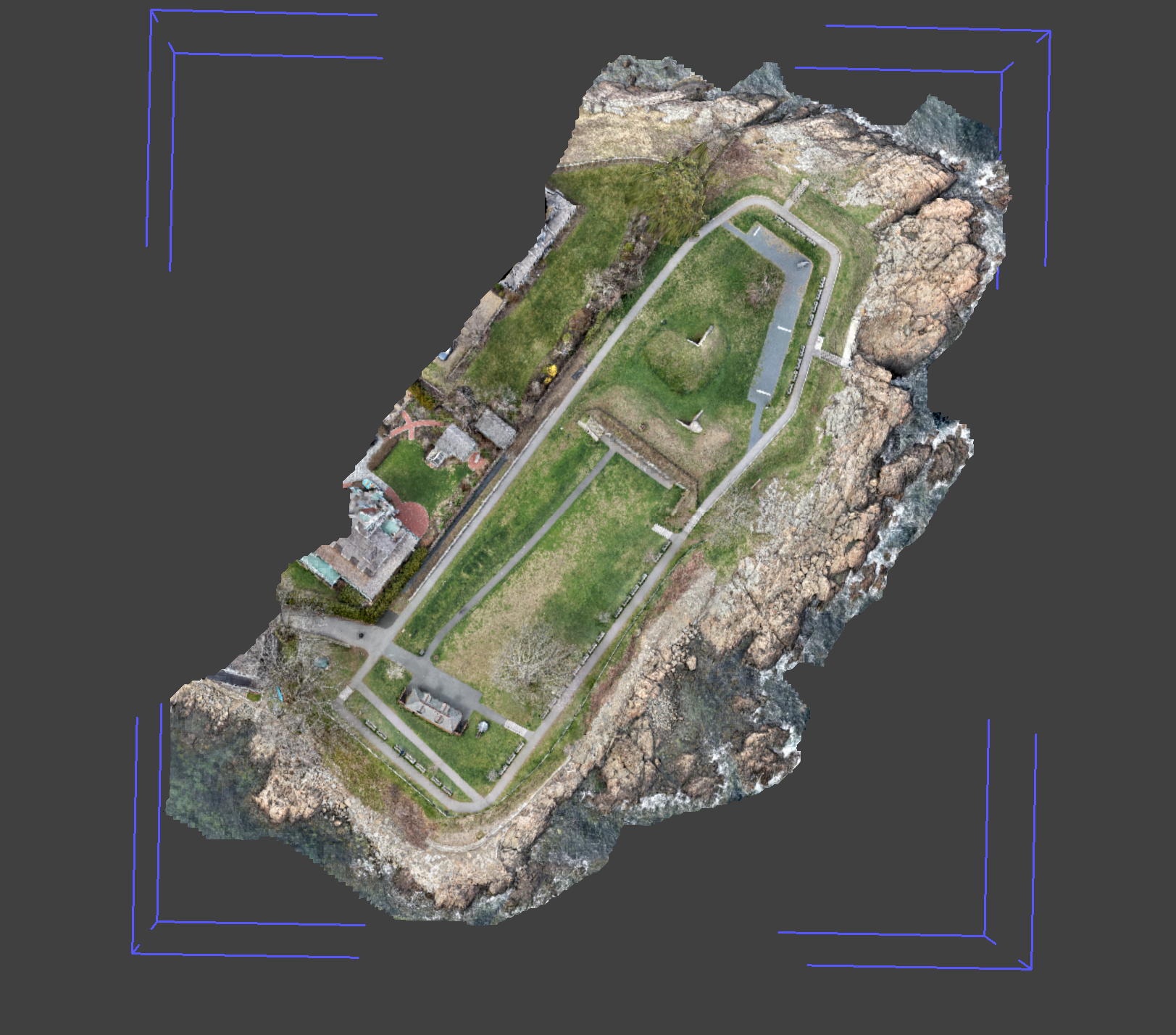
Orthomosaic Imaging: Accurate Aerial Mapping for Informed Decisions
Our orthomosaic imaging delivers georeferenced aerial maps with sub 1 meter level accuracy for marine construction, coastal monitoring, and infrastructure planning. This proven technology transforms hundreds of overlapping aerial images into seamless, high-resolution maps that support critical decision-making across your project lifecycle.